Lot 241
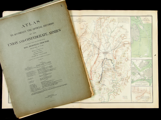
Atlas to Accompany the Official Records of the Union and Confederate Armies. Compiled by Capt. Calvin D. Cowles, published in Washington, 1891-95, 35 parts in original wraps (some separated and torn), with 175 maps and plates. Since both Union and Confederate sources were used in their compilation, the maps present a well-balanced cartographic record of the war. Inside pages are very good to fine. Also present is a 29 page index of Additions and Corrections, published in 1902.
The maps provide a great variety of information, from maps of individual battle sites to photographic views and uniforms and weaponry. There are also many broader-scale maps of regions, states, and the division of the country at various points during the war. The division of the plates is as follows: 1 � 35: Military Operations in the Field;136 � 161: General Topographic Maps; 162 - 171: Military Divisions and Departments;172 � 175: Miscellaneous. All of the maps are in lithographed color, primarily green, blue, and brown, with the Union Army positions in blue and Confederate positions shown in red. City views are sepia-tone lithographs made from actual photos. This atlas is the definitive source for Civil War information. Howes C816.
Estimated Value $2,500 - 3,000.
|
| |
| Unsold |