Goldberg Coins and Collectibles


Sale 79


press UP arrow key to increase the zoom ratio.
press DOWN arrow key to decrease the zoom ratio.
press RIGHT arrow key to increase the zoom window size.
press LEFT arrow key to decrease the zoom window size.

Lot 306

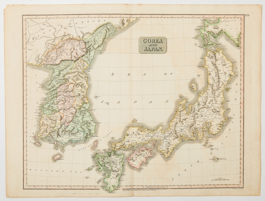
Korea and Japan, Early 19th Century Map. Entitled "Corea and Japan", this far eastern map is from "Thomson's New General Atlas", dated August 16, 1815. Large format (printed plate area of 25" x 20" plus margins) depicting the Korean Peninsula and the islands of Japan with, at upper right, the Russian island of Jesso. Nicely colored, with the Korean provinces especially detailed. A half inch chip off one corner and with normal age tone, otherwise very good condition. Now quite popular and getting scarce.
Estimated Value $300-UP.

 
Unsold


Go to lot:  


Home | Current Sale | Calendar of Events | Bidding | Consign | About Us | Contact | Archives | Log In

US Coins & Currency | World & Ancient Coins | Manuscripts & Collectibles | Bonded CA Auctioneers No. 3S9543300
11400 W. Olympic Blvd, Suite 800, Los Angeles CA 90064 | 310. 551.2646 ph | 310.551.2626 fx | 800.978.2646 toll free

© 2011 Ira & Larry Goldberg Coins & Collectibles, All Rights Reserved
info@goldbergcoins.com