Lot 196
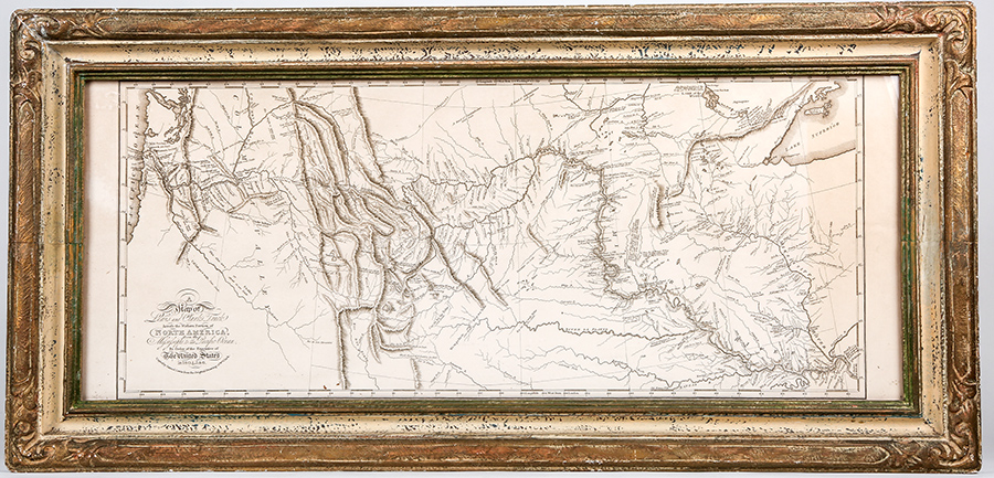
Map of Lewis and Clark's Track. An incredible journey of over 8,000 miles presented in "A Map of Lewis and Clark's Track, Across the Western Portion of North America From the Mississippi to the Pacific Ocean; By Order of the Executive of the United States, in 1804, 5 & 6." Copied by Samuel Lewis from the Original Drawing of Wm. Clark. Published in 1814 by Bradford and Inskeep, Philadelphia. The map is tan and measures: 13 x 30½ inches. Light staining along right vertical margin. Handsomely framed to an overall size of 16½ x 34½ inches. The principal objective of Lewis and Clark's Corps of Discovery 1804-06 was the mapping of the West to the Pacific Ocean. Clark's final cartographic achievement was his 1814 engraved map. One of the great maps of all times, it is perhaps the single most influential one of the American West, for it was upon this map that our modern understanding of the topography of that vast areas would evolve. Fine.
Estimated Value $250-UP.
|
| |
| Realized $1,199 |