|
Sale 49
Manuscript, Collectibles and Aerospace Auction
| Lot |
Photo |
Description |
Realized |
Lot 1115 |
 |
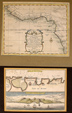
Hand colored map of Northern England. Original hand-colored map, dated 1611 of Northern England (Northumbria) showing boundary with Scotland. 14¼ x 18½ inches framed to overall size of 19 x 23¾ inches.
Estimated Value $500 - 650.
View details and enlarged photo
| Unsold |
Lot 1116 |
 |
Six Framed Prints of the Thompson and West Views of Los Angeles. These prints measure 16¼ x 23¾ in., matted and framed to 22¼ x 27¼ in. Included is a 1959 volume of "Views of Los Angeles" by Thompson and West.
Estimated Value $500 - 600.
View details and enlarged photo
| Realized
$552 |
Lot 1117 |
 |
1860 Map of San Diego Harbor. Hand-colored map, 9½ x 8½ inches, framed and matted to overall size of 14 x 15 inches.
Estimated Value $300 - 450.
View details and enlarged photo
| Unsold |
Lot 1118 |
 |
Original 1779 Map of North Pacific. This hand-colored map by DeVaugondy, Paris. Chart of the discoveries of Admiral D. Fonte, covers the North Pacific showing Japan, Russia and California, all inaccurate. Shows the mythical Northwest Passage and Sea of the West. Original engraving colored from Diderot Enc. 15 x 11½ inches, framed to overall size of 17 x 20½ inches.
Estimated Value $300 - 450.
View details and enlarged photo
| Unsold |
Lot 1119 |
 |
Original 1777 Engraved Plate Framed. Middleton's complete system of geography showing natives of California. Included are: "A Man of California fishing on his Bark Log," "A Man of the Same Country returned from fishing" and "A Californian Lady of Distinction." Prints are 10½ x 7½ in. matted and framed to 22 x 18 in.
Estimated Value $275 - 375.
View details and enlarged photo
| Unsold |
Lot 1120 |
 |
1911 Map of Downtown Los Angeles. This is Baist's Real Estate Atlas of surveys of Los Angeles. Atlas plate 7 hand-colored. Map is 33½ x 23½ in. framed to 35½ x 25½ in.
Estimated Value $200 - 250.
View details and enlarged photo
| Unsold |
Lot 1121 |
 |
1875 Map & Description of Flood Control In New Orleans. Map and Description, "The Topography and Drainage of New Orleans," by Thomas S. Hardee, City Surveyor, 19¾ x 14½ in. report with a 7½ x 7 in. map, 1875. The existing and proposed system for flood control in New Orleans. The system includes drainage machines at several key locations and a 50 foot wide levee, build 4 to 6 feet above the highest known water level. This report notes that the Mississippi River rises and falls as much as 15 feet with the tides. City Surveyor T.S. Hardee concludes this report by saying: "The future of New Orleans, as a great and populous city, depends more upon the successful solution of this drainage problem than almost any other question connected with her welfare." The recent hurricane and flooding of New Orleans certainly confirms Hardee's conclusions. Fine; a couple of tiny tears in the lower left corner.
Estimated Value $200 - 300.
View details and enlarged photo
| Unsold |
Lot 1122 |
 |
Two Slavery-Related Maps. "Carte de la Coste Occidentale d'Afrique Depuis le XIIe. Degré de Latitude Septentrionale, Jusqu'au XIe. Degré de Latitude Meridionale…." (Nicholas Bellin), 1739, 9 x 11¾ in., including margins. Handcolored, detailed map of the West Coast of Africa, from the Rio Grande in Senegal to just south of Angola. Many place names are shown along the coast, including the "Coste des Esclaves." "With handcolored Pays de Burré" showing the "Baye de Sierra Leona" at the top and at the bottom, a "Veue de l'Entrée de la Baye de Sierra Leona," engraved by Dheutland, 7¼ x 10¼ in. During the 18th century many slaves from Sierra Leone were brought into South Carolina and Georgia because they knew how to cultivate rice.
Estimated Value $150 - 200.
View details and enlarged photo
| Unsold |
Lot 1123 |
 |
1845 Map of California. Important pre-Fremont map of upper California showing Dr. Lyman's and Farnham's routes to California. The second lake Timpanagos is almost gone. Sutter's Colony shown, before gold discovery. The Mission and Channel Island shown. Indian tribes throughout. Mount Shasta is "volcano". A primative mountain range is now shown east of the coastal mountains, blocking the river paths from San Francisco to Salt Lake. The early Spanish missions in upper California are all shown. A terrific pre-Fremont map. Map is 11 x 14 in., matted and framed to 18¾ x 23 ¼ in. On reverse is a map of Texas.
Estimated Value $250 - 350.
View details and enlarged photo
| Realized
$748 |
Lot 1124 |
 |
Americae nova Tabula. Auc: Guiljelmo Blaeuw, c. 1640. Willem Janszoon Blaeu (1571-1638). Copperplate engraving of the Western Hemisphere with full color, 16½ x 22 in. Carte-à-figures, featuring ten small panels of native figures along the sides and nine small panels of cities along the top. Inset of Greenland and Iceland. Eight sailing ships and four sea creatures fill the seas. Light soiling with a few small closed edge tears and a small area of paper replacement in the lower margin and at left tips. Attractively matted and framed to an overall size of 21¾ x 27 in. A beautiful and important map by the renowned Dutch cartographer.
Estimated Value $5,000 - 6,000.
View details and enlarged photo
| Unsold |
Lot 1125 |
 |
Three Maps. Hand-colored pen and ink globe drawing, 5½ in. diameter; 1850. With Saul Steinberg's view of North American holdings. Handdrawn watercolor and colored pencil globes of eastern and western hemispheres. 7 x 7 in., c. 1850, 2-sided. On back of the eastern hemisphere globe there is a map of North America. On back of western hemisphere globe there are small drawings, including one of a sailing ship. (3) Handdrawn and colored maps of S. America No. 2, 10 x 8 in., c. 1850. This map has islands indicating Robinson Crusoe's Island and Islands of Juan Fernandez.
Estimated Value $400 - 500.
View details and enlarged photo
| Unsold |
|
|


